
In 2026, the most valuable tool on your site isn't a crane or a surveyor's level. It's the insight captured from above. While many view an aerial shot as a simple visual add-on, the high-impact drone video construction Malaysia projects now demand has evolved into a critical strategic asset. It's th...
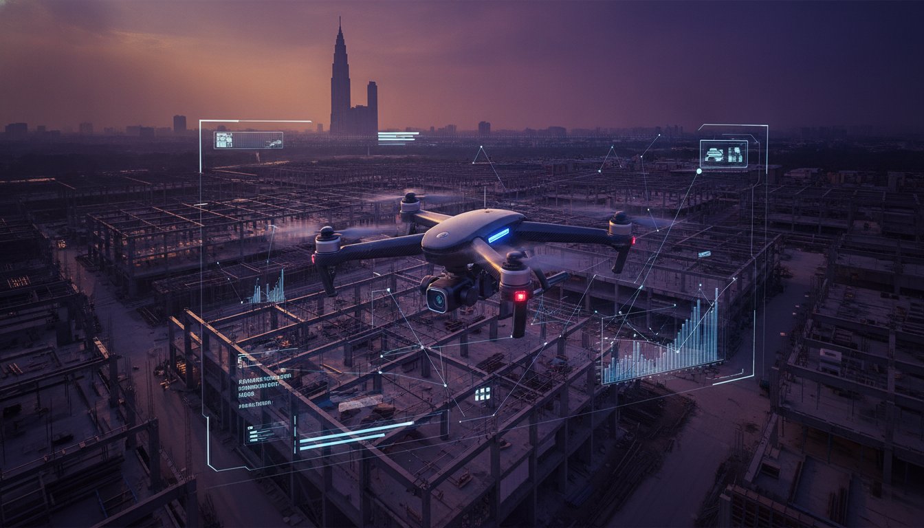
In 2026, the most valuable tool on your site isn't a crane or a surveyor's level. It's the insight captured from above. While many view an aerial shot as a simple visual add-on, the high-impact drone video construction Malaysia projects now demand has evolved into a critical strategic asset. It's the bridge between raw site reality and boardroom strategy. This isn't just about recording progress; it's about mastering perspective.
You've likely felt the frustration of trying to explain complex milestones to non-technical stakeholders using only spreadsheets or static photos. It's difficult to convey the true scale of momentum when your documentation feels inconsistent across a multi-year timeline. This guide will show you how to transform raw aerial footage into a powerful communication tool that satisfies both site engineers and global investors. We'll explore the shift toward integrated visual reporting, the essentials of CAAM regulatory compliance, and how to repurpose your progress data for high-impact ESG and corporate films.
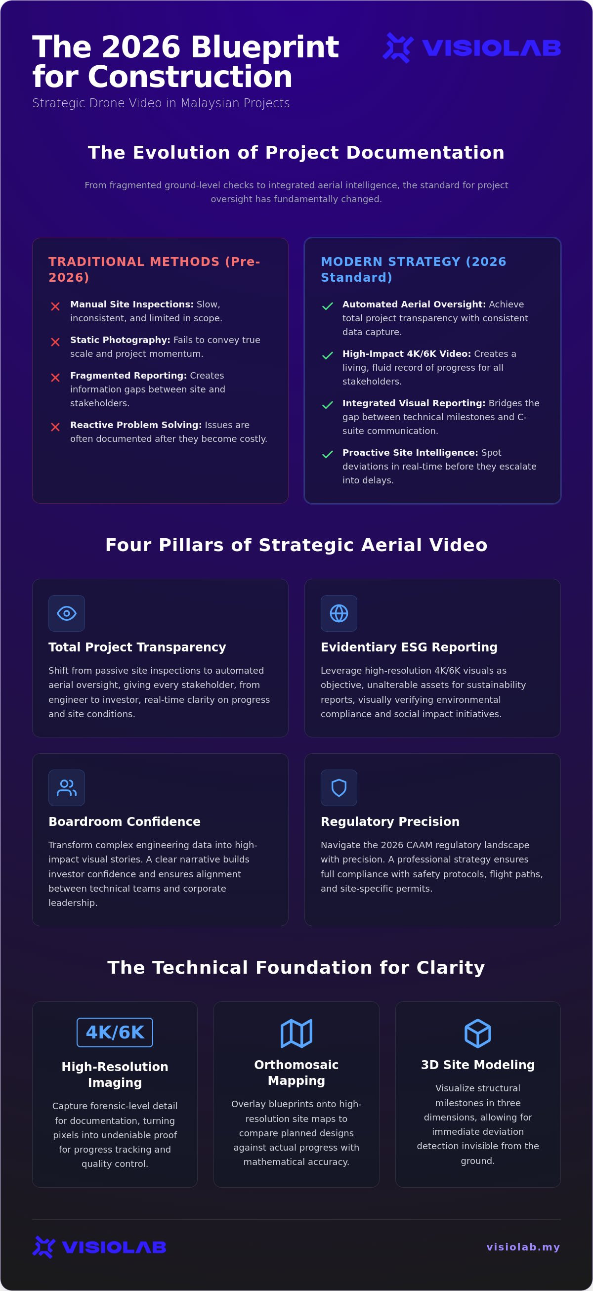
• Shift from passive site inspections to automated aerial oversight to achieve total project transparency and real-time clarity.
• Leverage high-resolution 4K and 6K visuals as objective, evidentiary assets for your ESG sustainability reporting and stakeholder presentations.
• Understand why a professional drone video construction Malaysia strategy prioritizes editorial narrative over simple equipment rental to drive boardroom confidence.
• Navigate the 2026 CAAM regulatory landscape with precision to ensure full compliance with safety protocols and site-specific flight permits.
• Transform complex engineering data into high-impact visual stories that bridge the gap between technical milestones and corporate communication.
The era of relying solely on ground-level site inspections is fading. In the past, project managers walked the perimeter with a clipboard and a handheld camera. Today, that approach is a liability. It's too slow; it's too fragmented. As infrastructure projects across the Klang Valley and beyond grow in complexity, static photography no longer meets the standard for 2026 demands. We've moved into a phase where drone video construction Malaysia serves as a multi-dimensional tool for total project transparency. It isn't just about taking a picture from the sky. It's about creating a living record of progress that moves at the speed of modern industry.
Automated aerial oversight has replaced manual spot checks. This transition marks a shift from reactive documentation to proactive site intelligence. High-impact visuals aren't just for marketing; they're the foundation of modern project management. When you can see the entire site in a single, fluid motion, you're no longer guessing at the pace of work. You're witnessing it. This clarity transforms the way teams communicate, ensuring that every layer of the project is visible, verified, and accounted for.
Drone footage used to be a luxury. Now, it's a standard requirement for GLC and government tenders. This shift reflects a deeper change in how we value data. Raw footage is just noise; a strategic progress narrative is a signal. By integrating aerial oversight into professional Construction management frameworks, teams can spot site deviations before they become costly delays. It's the difference between seeing a problem and solving it in real-time. In the Malaysian market, drone video construction Malaysia has become the benchmark for operational excellence. It's no longer enough to just fly; you must document with intent.
Site data is often dense and technical. For a non-technical board of directors or a group of investors, a 50-page report can be opaque. High-impact visuals bridge this gap. A bird’s-eye view provides immediate, undeniable transparency. It builds confidence through clarity. When stakeholders can see the site's momentum in 4K resolution, the distance between the field and the headquarters disappears. Perspective becomes your most persuasive asset. Using video to translate complex engineering milestones into a clear narrative ensures that everyone, from the site office to the C-suite, stays aligned with the project's ultimate vision.
High resolution is not a vanity metric. In the context of industrial documentation, 4K and 6K sensors capture the granular site detail necessary for forensic-level documentation. Integrating a professional drone video construction Malaysia strategy into your workflow ensures that every bolt, beam, and safety barrier is accounted for. It's about turning pixels into proof. This level of detail allows project managers to zoom into specific structural elements without losing clarity, providing a level of oversight that was previously impossible from ground level.
ESG reporting in 2026 requires more than just promises; it requires visual verification. Drone footage provides an objective, unalterable record of environmental mitigation efforts, land rehabilitation progress, and green initiatives. You can easily repurpose this high-fidelity site footage for ESG video production Malaysia to demonstrate social impact to global investors. It's the most efficient way to document community safety protocols and environmental compliance without disrupting site operations. Visualizing your commitment to sustainability builds a narrative of trust that spreadsheets alone cannot achieve.
Precision documentation goes beyond capturing wide shots. Orthomosaic mapping and 3D site modeling allow project managers to compare planned blueprints against actual progress with mathematical accuracy. By using advanced overlay techniques, you can visualize structural milestones that remain invisible from the ground. This technical depth is a core component of a modern construction progress video Malaysia strategy. It allows for immediate deviation detection; it ensures that what is designed is what is built. These assets don't just record history; they prevent future errors.
When site data is this clear, decision-making becomes faster and more confident. You aren't just looking at a video file; you're looking at a strategic asset that protects your project's reputation and bottom line. A high-impact drone video construction Malaysia approach ensures that perspective remains your ultimate tool for accountability. If you want to elevate your site's narrative, exploring a partnership with a visionary documentation expert can help bridge the gap between technical reality and stakeholder perception. This synergy between creative storytelling and technical precision is what defines the next generation of Malaysian infrastructure projects.
A drone is a tool; a narrative is a strategy. Many project managers make the mistake of treating drone video construction Malaysia as a simple equipment rental service. They look for the lowest day rate and the newest hardware. But in 2026, the hardware is secondary to the insight. Capturing raw footage is easy; crafting a project narrative that aligns with corporate objectives is where the real value lies. Editorial clarity matters more than flight hours because it transforms a random collection of clips into a coherent record of achievement.
The difference between a basic pilot and a strategic partner becomes clear during the review process. A freelancer delivers files; an agency delivers solutions. When you invest in strategic production, you aren't just paying for a flight. You're paying for the ability to translate complex site data into a story that resonates with investors and government bodies. This involves sophisticated post-production, where motion graphics and data overlays turn a simple aerial view into a dynamic map of project health. It's the bridge between what is happening on-site and what needs to be reported in the boardroom.
Technical flight skills are the baseline. They represent only about 30% of the total value provided. The remaining 70% comes from an agency's ability to understand corporate messaging and the nuances of project timelines. A pilot sees a crane; a strategic architect sees a milestone. This framework also prioritizes risk management. Professional continuity means having the insurance, liability coverage, and regulatory expertise to operate on high-stakes infrastructure without hesitation. You don't just need someone who can fly. You need someone who understands the weight of your project's reputation.
Strategic documentation is an exercise in efficiency. A single flight should serve multiple masters. While the site team uses the footage for progress tracking, the marketing department can use it for brand storytelling, and HR can use it for safety training. This multi-departmental utility is only possible when the capture process is guided by a broad vision. Centralizing these visual assets creates a historical archive that is invaluable for national infrastructure projects. It ensures that your data lives beyond the construction phase. Choosing a video production agency malaysia with deep industrial expertise is the only way to guarantee this level of asset longevity. You aren't just documenting a build; you're building a legacy.
Strategy without execution is just an idea. For drone video construction Malaysia to deliver real-world utility, it needs a framework that respects both the law and the site's pulse. This isn't about flying when the weather looks good. It's about establishing a repeatable process that integrates with your existing project management software. Precision in implementation ensures that your visual record is as reliable as your engineering blueprints. It's the difference between a random clip and a strategic asset.
The Malaysian airspace in 2026 is a strictly governed workspace. Every commercial pilot must hold a Remote Certificate of Competency Basic (RCoC-B) from the Civil Aviation Authority of Malaysia (CAAM). There are no shortcuts. Every mission requires an Authorization to Fly (ATF) permit, submitted at least 14 working days before the propellers spin. With a standard fee of RM250 for drones under 20kg, this permit is the bedrock of your legal compliance. Staying below the 120-meter altitude limit is non-negotiable; exceeding it invites fines up to RM50,000. These aren't just rules. They're the guardrails that protect your project's liability and reputation.
Consistency builds the story. You must schedule flights to align with major milestones: piling, structural capping, and final handover. This rhythm allows site engineers to use the footage for technical accuracy while the corporate team uses it for stakeholder reporting. You need to standardize your deliverables. Raw data serves the engineers; edited montages serve the boardroom. This dual-purpose approach maximizes the value of every flight. Integrating these visuals into your CIDB safety protocols ensures that aerial oversight never compromises ground-level security. It's a partnership between the lens and the level.
Data security is the final, critical pillar. For sensitive government or GLC projects, your visual assets are proprietary data. You need a management system that offers encrypted storage and tiered access. You wouldn't leave your blueprints on a public bench; don't leave your aerial data on an unsecured drive. If you're ready to deploy a professional documentation strategy, reach out to a visionary documentation architect to secure your project's perspective and ensure full regulatory compliance.
Perspective is a privilege; clarity is a choice. At VISIOLAB, we function as the visionary architect for your project's visual record. We don't just capture footage; we architect narratives. In an industry where raw data is abundant, clarity remains the scarcest resource. Our approach to drone video construction Malaysia projects is built on a "strategy first" philosophy. We translate complex infrastructure data into clear, high-impact visual stories that bridge the gap between technical site reality and corporate vision. By combining aerial precision with strategic corporate video production in Malaysia, we ensure your project documentation serves as a powerful communication asset for stakeholders.
Since our founding in 2016, we've specialized in translating complex organizational messages into digestible, high-impact content. We understand the weight of national infrastructure. We know that for GLCs and MNCs, a video is more than a file; it's a record of compliance, a tool for investor relations, and a legacy of progress. Our dual mastery of creative storytelling and technical execution allows us to deliver results that are both visually stunning and strategically sound. We don't just fly drones; we document the future of Malaysia's landscape.
Ambition requires discipline. National projects choose us because we provide more than just a pilot; we provide a comprehensive documentation ecosystem. We manage the entire lifecycle of the visual asset, from navigating the 14-day CAAM permit lead times to integrating 3D motion graphics that highlight structural milestones. This end-to-end management ensures professional continuity and mitigates site risks. By layering aerial footage with long-term timelapse and data-driven animations, we create a multi-dimensional view of progress. This commitment to editorial clarity ensures that your drone video construction Malaysia assets are ready for the boardroom, the press, and the historical archive.
A long-term documentation partnership is an investment in your project's transparency. We customize our visual tools to meet the specific needs of your stakeholders, whether they require granular engineering details or high-level ESG reporting. We don't believe in one-size-fits-all solutions. Instead, we align our flight schedules and post-production workflows with your project's unique pulse. This ensures that every deliverable adds tangible value to your reporting cycle. If you're ready to transform your site data into a strategic narrative, contact VISIOLAB for a Strategic Documentation Consultation and discover how we can elevate your project's perspective.
The transition from manual site checks to automated aerial oversight is now complete. In 2026, project success is measured by transparency and the clarity of stakeholder reporting. You've seen how high-impact visuals serve as objective evidence for ESG claims; you've understood the critical nature of CAAM regulatory precision. Implementing a professional drone video construction Malaysia strategy is no longer a luxury for national infrastructure. It's the standard for operational excellence and investor trust.
Since our founding in 2016, VISIOLAB has specialized in serving the GLC and government sectors with professional discipline. We provide national coverage across Malaysia, ensuring that your most ambitious projects are documented with technical precision and editorial insight. It's time to move beyond basic aerial shots and start building a visual legacy that resonates in the boardroom. Partner with VISIOLAB for Strategic Construction Documentation to transform your site data into a powerful strategic asset. We're ready to help you visualize every milestone with total confidence.
Yes, commercial drone operations are fully legal provided they adhere to the Civil Aviation Authority of Malaysia (CAAM) framework. You must ensure the pilot holds a valid license and that a site-specific permit is secured for every mission. Operating without these credentials can result in fines up to RM50,000 or prison time, making compliance the first step in any documentation strategy.
All commercial pilots must hold a Remote Certificate of Competency Basic (RCoC-B). Additionally, every flight requires an Authorization to Fly (ATF) permit, which must be submitted at least 14 working days before the scheduled flight. Drones must also stay below the 120-meter altitude limit and avoid airport exclusion zones unless specific clearance is granted by air traffic control.
Monthly captures are the standard for a professional drone video construction Malaysia workflow. This frequency provides enough data to track significant momentum without cluttering your project management archive. For high-velocity infrastructure projects, bi-monthly flights ensure that technical milestones like foundation capping or structural topping out are documented with precision.
Aerial oversight is a primary tool for modern safety audits. Drones allow safety officers to inspect high-risk areas, such as tower crane integrity or perimeter fencing, without putting personnel in harm's way. This visual data provides an objective record of PPE compliance and site cleanliness, which is essential for CIDB protocols and internal safety reporting.
Drone video offers dynamic, fluid perspectives that capture the scale and activity of a live site. Long-term timelapse utilizes fixed ground cameras to compress months or years of construction into a few minutes of footage. While drones provide granular site intelligence, timelapse offers a broad chronological narrative; using both creates a comprehensive visual record.
Costs are calculated on a project-by-project basis because every site has unique complexities. Factors such as flight frequency, the required resolution (4K or 6K), and the depth of post-production data overlays influence the final quote. Agencies typically offer customized packages that align with the specific reporting cycles and stakeholder needs of your organization.
Yes, an ATF permit is specific to the flight dates and coordinates of a single mission. You cannot use a single permit for the entire duration of a multi-year project. Planning your documentation schedule 14 working days in advance is critical to ensure that your legal coverage matches your project's major milestones.
Integrating 3D motion graphics is the most effective way to visualize "planned vs. actual" progress. By overlaying digital blueprints onto real-world aerial footage, you can show stakeholders exactly how the finished structure will inhabit the current site. This synergy between creative technology and raw data is a core strength of professional documentation architects.
Let’s create and collaborate
We’re versatile multitaskers, and we thrive on a lot of projects. You've seen a few of our works that we are most proud of, and your project could be next in line.

Empowering brands with captivating visual stories, creating strong connections and growth.
